onX HUNT mapping for both the Garmin GPS (colored – microchip capable) and mobile device, such as the smart phones which 90% of hunters and outdoor enthusiasts carry with them 24/7.
Emergency Beacon Needs to be registered.
The Garmin GPS, at least in the 21st should have WAAS (Wide Area Augmentable System) Note: Global Positioning System GPS is made up of at least 24 satellites, working in all conditions 24 hours a day and is FREE.
Garmin Rino 755 has two way and your location is available to another user. This is one that I highly recommend.
I would say at least 40% tell me they are “Old School” and use paper maps and a compass (that is maybe on the compass).
Just one little note with onX HUNT on the mobile side there is a trail layer that features trails old and new (CONUS). Another tool that can help in many hunting areas.
Let’s get real about paper maps, most are outdated, and boundaries change all the time. I threw out all my paper maps, that I have had for more than 30 years with all the X’s on them, moving the X’s to my GPS. Paper maps are outdate in field use and lacking the ability to Zoom in. Even if you mark your map with routes, it surely isn’t going let you do an active route back to camp or truck as a GPS would do. As for the compass, it’s Okay, if your batteries go dead or enemy decides to use an electromagnetic pulse or EMP while you’re in the back country.
These can reach out many miles and reasonable in price in the pairs.
Beside the Garmin GPS, Mobile Phone with the onX HUNT APP and chip, there is the 2 Ways such as Motorola handheld communicators, and last but not lease is an Emergency Locator Beacon, just in case you’re in real trouble and are immobile…
We must remember to have them in our backpack or ditty bag (U.S. NAVY), along with the other tools used in the field. Frank Biggs
Thoughts go back to my early days of hunting elk with a rifle and bow. I would rifle hunt in the eastern part of Oregon for Rocky Mountain bulls, while bow hunting was in the western part of Oregon for Roosevelt bulls. So those early hunts to the east were about going into the timber and waiting for elk to come by within shooting range. One thing I never did was to build a fire to keep warm, but my uncles all did it. I remember on one hunt Uncle Floyd was deep into the pines up near Texas Butte. You could hear him cough, as he was a smoker, plus he had his fire going. That was something that his sons and I would never do. Low and behold a nice respectable 5X5 came by his fire and he put him down… So in the western part of the state, we would go into our favorite spot and walk pockets listening for elk movement and try to get in close enough to get shot. They never seem to do the calling like Rocky Mtn. elk would do. This process of hunting worked for us in those days.
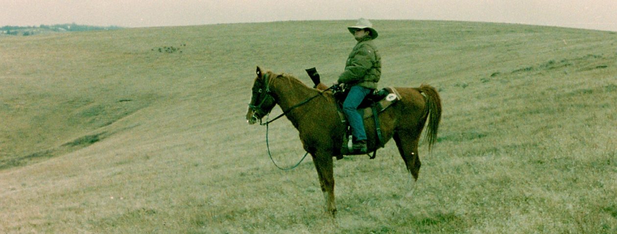
This happens to be from the 2015 first season Rocky Mtn. Elk season in Oregon. It is an old haunt that I have introduced my son too. So my son and his cousin, knowing the area had never used a GPS went hunting with the new Garmin 64’s and onXmaps Hunt Plat map installed (I demanded they have them to stay legal). As you can see he stayed legal. There is some access for the public near the river, that is grandfathered in for about 50 years or more. In this country it is about seeing the elk, deer and pronghorn and chasing after them. Open country with Junipers, sagebrush, rimrock, cheat grass and seeded grazing grasses (after range fires).
Getting to the basis of this article about chasing elk down as I would put it came about some years later when we were bowhunting the rimrock, juniper and sagebrush of central Oregon for big mule deer bucks on the B.L.M., National Forest that was bordered and encompassed with private land. One particular deer scouting trip prior to the opening archery season, glassing at a mile into a basin we could see from our observation point while looking for the famous bucks of the Big Muddy, we spotted elk, not just one elk, but about 12 bulls, all being branch bulls.
This bull was spotted with another bull at about 2000 yards. I shot this bull at 50 yards. Both bulls were taken, one by myself and my partner, after we split up in the draw. We watched the bull at about 200 yards split up.
This launched our elk hunting in this country for more than 20 years and still to this day when I have time. Spotting elk from distance does give you an advantage; this has led to least at 85% average of getting elk this way for me, partners and others within the hunting circles. I will say that in the early days, GPS and mapping (software) was nil. Most of the guys I hunted with were all past military and few of us still in the military, so venturing into the so call unknown and reading the land was pretty easy going.
I have found glassing ridges, hillsides, shaded areas and even into basins on an afternoon after the average hunter has headed back to camp and settle down for the late afternoon and evening happens to be my favorite time to glass for elk. The country is vast with B.L.M. and National Forest for miles in all directions. You have been glassing for about 30 minutes and you spot a group of elk which you feel is about 2 miles away. You can see with your binoculars there are some pretty good bulls in the herd. They are just grazing, with a few bedded down. It is said by most that we have probably harvest more elk in the afternoon after 1PM, than ever in the morning hours.
This bull was taken by my son. We all spotted the elk at a mile away. I decided with my son, Brian Henninger’s brother John and a buddy of my son to go after him. I got my son within 50 feet of the bedded bull. In the picture if Brian Henninger PGA. On this hunt all the hunters got a bull within 2 hours of each other.
It is now to setup a plan to get onto these elk, as it is about 1400 or 2PM in the afternoon with visibility of at least a mile.
Getting this plan underway in the 21st century is so much easier with Garmin GPS’s and onXmaps HUNT mapping software and being able to dial in the lay of the land with precision accuracy, sort of like getting 10X’s on a target during a shooting tournament…
First off, I would have my Garmin GPS, with the Montana being my favorite which is loaded with my onXmaps HUNT PLAT map. Seeing that there is a peak off in the distance between the elk and myself, I can judge the precise distance to the elk with the mapping and GPS. The maps are up to date and show the private, federal lands, state lands and other.
This bull was spotted at about 1/2 mile away. On this bull, I thought it was another bull seen earlier. Only had a side profile when I launched a 210 gr. Nosler Partition at 600 yards.
The second thing I am going to do is install a number of waypoints, such as the peak and the proximity of elk as I see it on the map.
Now I take a look at the topo aspect of the terrain with my GPS and my eyes, working on a quick plan to cover the distance to within a ¼ mile of the elk. The elk appear to be very comfortable were they are and I feel they will settle down in the area for part of the evening.
Personally I have always felt to cover the ground quickly, whether I am running, sliding down a hill, but always slowly down coming up on a rise. Many times I personally feel that mistakes are made by taking too much time getting in the zone of the elk.
This bull was called in to within 20 yards after being spotted about 1000 yards away. We covered ground to within 100 yards of the herd. A bit of small bull and cow call called him in. Plus we had cut off some of his cows.
During my pursuit I am mentally thinking how I am going ambush the elk. I also assume that the elk will be close to where I had made sight of them. If rifle hunting, the thought of the ambush will be different than if I am bowhunting the elk as to how close I close the distance. I am a loner, but if I have a partner, he is going to be in my shadows normally, but under the same game plan. I am in combat mode when working this scenario during the hunt.
Along the way I have checked my GPS and even put more waypoints, which gives me a mental picture, plus I have setup estimated time to get to my final observation point, whether a vantage point above or even level eyesight.
This bull was spotted from a mountain top a very long ways away. Michael Jame of Bend, OR took him out at 100 yards. Michael has always been a believer of getting in fast.
Now if I am rifle hunting, I will be on the ready and try to have a vantage point within my comfortable shooting distance. A great deal of time that doesn’t always happen, but I have set this stalk up the way it works for me. I know my weapon or rifle of choice that I use on elk and I also know the capabilities of its shooting distance and putting the elk down.
This bull was shot from long range, but spotted earlier in the evening along with another bull of the same size. Three bulls were taken within 10 minutes of each other. After my son’s bull was down and heading back, heard a shot in another basin. That shot was from Brian Henninger. Two bulls came out of the basin, one dropped from Brian’s close range shot. The other bull stopped, by that time I was on the hard deck in the prone position with By-Pod flipped down. Raised 4 feet over the back, pulled the trigger on the 340 Weatherby with 225 gr. Barnes X and the bull dropped in his tracks. “Never seen anyone shoot that far” (John Henninger). My comment was the Barnes X must have given it a heart attack. No time to chase this bull down, take the shot or let it go.
When it comes to archery, I am more of a stalker of elk too within shooting range, a great deal depends with the elk, being in the rut or not, but I always have cow call and a bugle if I am going to work the herd and bring a try bull in.
With the technology of GPS (Garmin) and onXmaps HUNT mapping software, the hunter can pinpoint the game. As said before, my thoughts have always been to move fast and not worry about being careful about foot noise, until I am within a ¼ mile. In reality this is one of the funniest ways to hunt down an elk in my opinion! My partners and I have taken many bulls over the years by hunting this way.
There is an old saying by Sailors’, “is you’re “Ditty Bag” complete?” A sailor would rely on the “Ditty Bag” to have his most important items in it… No “Ditty Bag” with the essentials for the hunter, outdoor adventurer, fisherman or hiker is an incomplete tool bag. Today’s “Ditty Bag” will appear as a duffle bag or backpack of sorts.
I see it everywhere, the youth and now even the older generation using mobile devices. There are so many APPS out there; a mobile device can do just about anything imagined. APPS have made it easy for everyone to navigate through a daily routine.
“Ditty Bag” A major essential for the complete outdoor person would be an IPad or IPhone or Android Device and last not lest a Garmin GPS (Color Screen – Micro SD Slot). My mobile device is Apple IPad that seems to go everywhere with me and has the onXmaps APP. It is the great research tool that I have in my “Ditty Bag”, it’s like a talking encyclopedia, only it is visual and easy to understand. As simple as turning on the device, opening the onXmaps HUNT APP and then letting my fingers do the work.
There are three (3) ways to think of the essentials when it comes to mapping in my mind. The mobile device is for scouting and in the field use. The laptop (most common computer) is for scouting and the GPS is all about in the field and scouting secondary.
I have 18 layers of information that overlay the 12 available basemaps, also with 5 western states PLATS loaded on my IPad. The operator gets to decide which overlay or overlays, basemap or basemaps they want to use in their research or the use in the field. Many outdoor people use their phone such as an Android or one of the many Apple IPhones for everything. The onXmaps HUNT APP makes it quite easy to use in the course again of daily routine.
onXmaps Hunt – Easy to use!
The list is long, but each and every layer & basemap is a valuable tool to those that want to gain knowledge! One has to study the land and learn the habits of the game to be successful.
Another thought is that we meet a lot of people in the field and most like to talk about their hunts or adventurers; I have found many to give road numbers, landmarks and whatever else embellishes the adventurer. End result is that I am going to absorb the information and it is loaded to my IPad, GPS and laptop.
As you note in my “Ditty Bag”, I also have my Garmin Montana GPS, this is also a must when in the field. Sometimes, in a deep dark canyon, you might not have mobile device reception and I rely on my Garmin to be accurate in tight areas…
The savvy hunter or outdoor persons will purchase the whole meal deal, everything for the mobile device and for the Garmin GPS (colored monitor-micro-chip slot) and or download to the computer to up-load to the GPS, then back to the computer. I back-up my waypoints and adventurers to my laptop.
I have only touched surface of what this great mapping tool can do for you, it is time for you to buy and check it.
My “Ditty Bag” has the following items in it, Garmin Montana GPS/onXmaps Hunt software, IPad/onXmaps Hunt APP, Benchmade Knives (2), 12×50 Bausch & Lomb Binoculars, Nikon SLR Camera, Oregon Hunt/Fish License/Tags, rubber gloves, matches, Leatherman, toilet paper and money! Everything else, I pack in my hands or on my body…
My lasting thought to all that read this is, with this technology, inertly trespassing is a thing of the past. In many states, it is the requirement of the trespasser to know where they are and law enforcement and landowner does not have to prove you were trespassing…
The technology is here for all to enjoy accurate mapping in the field!
How many people know that Wyoming was the first to make jumping B.L.M. corners a trespassing violation? It is the same in Oregon, as I have tested the waters on this one. There is no need to trespass!
There is technology and mapping resources to keep you from unintentionally trespassing in the State of Oregon and many other states in the continental U.S. that has private land and public land in a mix of blocks with fences and without fences. In many cases hunters find the landowner and gain access to public land or even the private sector.
For many years I have been helping hunters find places to hunt for big game in the State of Oregon. In the four years I have been involved with new mapping technology and giving coordinates or waypoints to hunters at NO COST monetarily, none of my hunters that use the technology have ever had an issue. I have expected them to buy a GPS (Garmin) (colored screen) (SD Micro Ready) that interfaces with the Topo Mapping Software from onXmaps HUNT. Recently I have extended free service for those that are using Android and Apple devices. In this case with the onXmaps HUNT software loaded to the device, I can send them a Google Earth KLM file. This keeps it simple and fast for me to get them into the area, saving a great deal of time in the scouting of an area.
This is what you would see on an Mobile Device from a Google Earth from a KLM file download.
A bit of humor though, when checking back with the hunters after the hunt, I have asked where the pictures and short story are, some have told me “I didn’t find an antelope at the waypoint!” “But I did get kill one close to the spot!”
For those who are savvy with a computer to have the software on the computer and on a colored screen Garmin GPS there is limitless opportunity with the knowledge gained from using the technology.
The great thing about using onXmaps HUNT is that in many states you have the private, private timber lands, BLM, State Lands and National Forest lands distinctively marked for easy reference. In many counties you will see the blocks of private by land owner name. The onXmaps HUNT Information Technology team is always updating the maps when needed!
What does amaze me daily that many hunters who let’s say have waited 12-20 years for a pronghorn tag, still come back to me when they are using their computer to find me and my services and tell me they can’t afford a GPS or they tell me, “I have a paper map.” I don’t even carry paper maps in the field any longer.
This is how my Garmin GPS and Google Earth looks with onXmaps HUNT with waypoints and tracks. You decide if you want accuracy or gray zone!
The major problem with paper maps is that most are outdated and most will not show the small blocks of private land that are on Bureau of Land Management, State Lands (sometimes) or National Forest. Just one example is near Sumpter and Granite, Oregon where there are privately held mines on private land. Always interesting to see the names of the mines in some Oregon’s and other state’s remote locations. You won’t see that on most paper maps, little along on other mapping software. I can guarantee with a National Forest map or road map, you’re going to get a trespassing ticket if you rely on that source to keep you legal. A landowner up in this neck of the woods on an active mine, might not take too kindly to someone trespassing. Now if you had the onXmaps HUNT mapping, you might be able to find the landowner and get permission to hunt. Remember, asking is not that hard to do!
This would be the typical National Forest Map and other mapping companies software on a GPS Device.
Yet to this day in a moment of compassion, I will print a map from my onXmaps HUNT program, scan it and send it to a person so they can hunt. It is just not the same doing this rather than to have the waypoints on a GPS and while at camp, look at them on a laptop for the next day’s hunt. You can make a route to get to that hard to reach spot. For those that don’t have a Garmin, they might only get txt files and try to figure them out on a map. Land ownership and boundaries change over the years, just look at the boundaries of the Warm Springs Indian Reservation today versus 15 years ago.
Now this is the view of the above National Forest land with onXmaps HUNT software on a Garmin GPS.
Having a local tell you, “Once you get to the store in Hampton, there is a road that goes to the north out of town, travel for about a mile, stop at the first tree on the left, turn then once you cross the stream on Grade 7 road, then travel about 1 mile, then turn right at the big boulder with class of 70 painted on it, then up the hill until you see the pine tree, then take the second dirt road to the left” is utterly confusing. Most of us get lost!
I hear of hunters or outdoor people getting ticketed every day for trespassing unknowingly. The fine alone, if they get a good judge with compassion, you could have bought a new Garmin Montana and onXmaps HUNT SD Micro Card, and many sporting goods stores have package deals!
This is my Garmin Montana with onXmaps HUNT software. This is what it looks like and you can zoom in for greater accuracy!
The other amazing thing is that the GPS and the mapping software will give the hunter or outdoor person and insight into the unknown. You’ll find places you can go, that you never knew existed. These places aren’t advertised, but once you locate them by using the equipment, you can make the call or let’s say check with ODFW on private lands on which the public can hunt. Do you really think that timber companies advertise for the public to hunt their lands? They might have some lands open, but they also have some not opened to the public and yet both are posted the same way!
First off I can read a map, Military Training and the days of only having paper maps, but these days paper is for backup only, as GPS systems are so accurate and what they have to offer, such as backtracking, there is no way I would leave home without one!
In the old days the Global Positioning Systems could tell you where you have been via way-points and tracks.
Oh! One could plug in coordinates, but it still was a plot system. I use my laptop with mapping software all the time to locate new spots and then viewing it with Google Maps. If I have something good that I want to venture it is loaded to my Garmin GPS with mapping.
I have updated this POST with new Mapping Software that will enable the Hunter and Outdoors person the freedom to not have to look over your back and wonder if you are hunting public property. Recently I have put new mapping software to my Garmin Map Source on my Laptop and then download to the Micro SD Card that is in the slot on my Garmin Oregon 300.
New Garmin Montana with picture on screen
With this software you will be able to see BLM, State Lands, City Lands, Private Lands and National Forest Lands and Timber Company Lands are also on the software. Being I am in Oregon I went with the OR-PLAT4GPS. It is almost unbelievable what you see. I fee that everyone should have a Garmin that has a color screen, high sensitivity antenna and capabilities to accept a Micro SD Card.
Garmin Rino 520HCX – 2 way FRS/GMRS – Topo GPSNew Garmin Montana with picture on screen
Now the GPS can tell you where you have been, where you want to go and how to get there.It is like looking at a TV and understanding what you have in front of you. With the TOPO maps a GPS it can greatly make you get a gripe on the reality of using the GPS in the field.
If you understand Topo maps, you can identify with the lay of the land.Be able to find the shortest way out using the GPS.These days I can look at a map, have an idea of a place I have heard about or I want to visit.Plug it in, even go to Goggle Maps these days and see an aerial view of the place I want to hunt or have hunted.
Now we have new products that have GMRS and the mapping.If one has a partner with the same like GPS they can pinpoint each other.One has to love technology and what it can do for you.I have had great results with the Garmin Products!It is very easy to get the latest software updates from Garmin for your GPS Unit. You can view some their fine trail products at the following website.
Just think when you zoom in on this mapping for more detail, you might even find the name of the landowner of the private parcel. This is the greatest piece of mapping software that I have ever seen or had the privliage of using.
Just the other day up on the Santiam River in Oregon, I wanted to check out an area that I had seen elk a couple of years ago. What I found with new software was that they were in BLM, but next to a timber company. In checking with the timber company allows hunting. I am going to share this information with the waypoints to a customer of mine.
You can always send me an email if you have any further questions: bwanabubba@gmail.comCOBRA